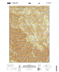
2020 Map of Silver Butte
USGS Topo · Published 2020About this map
The North Fork John Day River winds through the southern reaches of this landscape, forming a focal point for the North Fork John Day Wild and Scenic River area. This rugged corridor is defined by deep drainages such as Faulkner Gulch and McCarty Gulch, reflecting a terrain that has long challenged travelers and supported isolated outposts. High-elevation points like Silver Butte and the distinctive Wind Rock overlook a network of creek systems including Meadow Cr and Martin Cr.
Find a feature on this map
46 named features on this map. Tap any name to fly to it.
Don’t see what you’re looking for? This feature index may not catch every label — zoom into the map to look around manually.
Map Details
Editions of this 2020 Silver Butte Map
This is the sole edition of this map. No revisions or reprints were ever made.
Other maps of this area

1901 · Sumpter
USGS Topo · 1:125,000

1951 · Desolation Butte
USGS Topo · 1:62,500

1953 · Pendleton
USGS Topo · 1:250,000

1955 · Canyon City
USGS Topo · 1:250,000

1956 · Pendleton
USGS Topo · 1:250,000

1959 · Canyon City
USGS Topo · 1:250,000

1965 · Fly Valley
USGS Topo · 1:24,000

1967 · Tower Mtn
USGS Topo · 1:24,000

1967 · Pearson Ridge
USGS Topo · 1:24,000

1972 · Trout Meadows
USGS Topo · 1:24,000