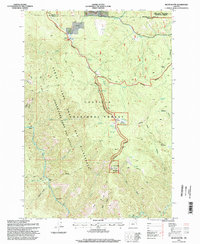
1995 Map of Silver Butte
USGS Topo · Published 1998About this map
Silver Butte rises as a central landmark within this high-elevation landscape of the Umatilla National Forest, where the topography is defined by the deep incisions of the North Fork John Day River. The area is characterized by a network of drainage systems, including Glade Creek and Ryder Creek, which flow through heavily contoured gulches toward the main river channel. Human presence is indicated by infrastructure tied to forest management and backcountry recreation, such as the Forks Guard Station and established campsites like Log Table Camp and Silver Spring Camp.
Find a feature on this map
51 named features on this map. Tap any name to fly to it.
Don’t see what you’re looking for? This feature index may not catch every label — zoom into the map to look around manually.
Map Details
Editions of this 1995 Silver Butte Map
This is the sole edition of this map. No revisions or reprints were ever made.
Other maps of this area

1901 · Sumpter
USGS Topo · 1:125,000

1951 · Desolation Butte
USGS Topo · 1:62,500

1953 · Pendleton
USGS Topo · 1:250,000

1955 · Canyon City
USGS Topo · 1:250,000

1956 · Pendleton
USGS Topo · 1:250,000

1959 · Canyon City
USGS Topo · 1:250,000

1965 · Fly Valley
USGS Topo · 1:24,000

1967 · Tower Mtn
USGS Topo · 1:24,000

1967 · Pearson Ridge
USGS Topo · 1:24,000

1972 · Trout Meadows
USGS Topo · 1:24,000