
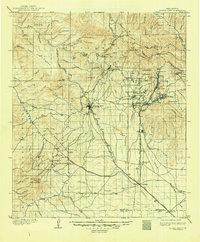
1909 Map of Silver City
USGS Topo · Published 1909About this map
Silver City stands as the central hub in this high-altitude landscape where mining and military history converge at the foot of the Gila National Forest. The map documents a busy industrial corridor during the early 20th century, with the Atchison Topeka and Santa Fe Railroad and its Deming and Silver City Branch serving vital camps like Santa Rita, Hanover, and Fierro. These settlements, alongside the Fort Bayard Military Reservation and its associated Forest Nursery, highlight the region's complex role as a center for extraction and government administration.
Find a feature on this map
99 named features on this map. Tap any name to fly to it.
Don’t see what you’re looking for? This feature index may not catch every label — zoom into the map to look around manually.
Map Details
Editions of this 1909 Silver City Map
2 editions found
Other maps of this area

1899 · Deming
USGS Topo · 1:125,000

1910 · Mogollon
USGS Topo · 1:125,000

1911 · Alum Mountain
USGS Topo · 1:125,000

1912 · Mogollon
USGS Topo · 1:125,000

1913 · Alum Mountain
USGS Topo · 1:125,000

1915 · Deming
USGS Topo · 1:125,000

1937 · Santa Rita
USGS Topo · 1:24,000

1947 · Allie Canyon
USGS Topo · 1:24,000

1947 · Twin Sisters
USGS Topo · 1:24,000

1947 · Faywood Station
USGS Topo · 1:24,000