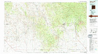
1994 Map of Silver City
USGS Topo · Published 1994About this map
The copper-rich landscape of Grant County is defined by its massive industrial footprints and high-desert terrain. Silver City serves as the regional hub, flanked by the enormous excavations of the Chino Mine and Tyrone Mine. These industrial sites, along with the Continental Mine and Bull Hill Mine, represent the backbone of the local economy, while the Atchison Topeka and Santa Fe RR provides the essential rail links connecting these mining districts to the outside world. To the east, the Fort Bayard State Medical Center occupies a significant historical site near Central and Bayard.
Find a feature on this map
60 named features on this map. Tap any name to fly to it.
Don’t see what you’re looking for? This feature index may not catch every label — zoom into the map to look around manually.
Map Details
Editions of this 1994 Silver City Map
This is the sole edition of this map. No revisions or reprints were ever made.
Other maps of this area

1899 · Deming
USGS Topo · 1:125,000

1909 · Silver City
USGS Topo · 1:125,000

1910 · Mogollon
USGS Topo · 1:125,000

1911 · Alum Mountain
USGS Topo · 1:125,000

1912 · Mogollon
USGS Topo · 1:125,000

1913 · Alum Mountain
USGS Topo · 1:125,000

1913 · Morenci
USGS Topo · 1:125,000

1915 · Morenci
USGS Topo · 1:125,000

1915 · Deming
USGS Topo · 1:125,000

1917 · San Simon
USGS Topo · 1:125,000