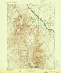
1898 Map of Silver City
USGS Topo · Published 1943About this map
Silver City and the surrounding Owyhee mining district serve as the primary focus of this late 19th-century reconnaissance survey. The map details the concentrated industrial activity in the southern mountains, where the Poorman Mine, Trade Dollar Mine, and Black Jack Mine are situated near the settlements of De Lamar, Dewey, and Florida. These locations underscore the region's historical importance as a silver and gold producing center.
Find a feature on this map
45 named features on this map. Tap any name to fly to it.
Don’t see what you’re looking for? This feature index may not catch every label — zoom into the map to look around manually.
Map Details
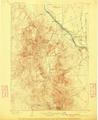
Editions of this 1898 Silver City Map
3 editions found
Other maps of this area

1892 · Boise
USGS Topo · 1:125,000

1892 · Bisuka
USGS Topo · 1:125,000

1892 · Silver City
USGS Topo · 1:125,000

1894 · Bisuka
USGS Topo · 1:125,000

1894 · Silver City
USGS Topo · 1:125,000

1897 · Boise
USGS Topo · 1:125,000

1898 · Nampa
USGS Topo · 1:125,000

1898 · Silver City
USGS Topo · 1:125,000

1906 · Mitchell Butte
USGS Topo · 1:125,000

1948 · Sinker Butte
USGS Topo · 1:24,000