
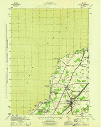
1944 Map of Silver Creek
USGS Topo · Published 1944About this map
Lake Erie dominates the northern horizon of this mid-century survey, where the village of Silver Creek serves as a busy hub for transportation and summer recreation. During this era, the shoreline is dotted with established seasonal communities such as Millers Beach, Lotus Point, and Brant Park. The landscape is heavily influenced by the convergence of major rail lines, including the New York Central and Pennsylvania and the Nickel Plate, which parallel the coast and support the region's industrial connectivity. Inland, the terrain softens into the agricultural and wooded areas of Hanover and Sheridan. To the northeast, the Cattaraugus Indian Reservation spans the boundary of Erie and Chautauqua counties at Cattaraugus Creek, while the Silver Creek Airport reflects the early aviation infrastructure of the 1940s.
Find a feature on this map
45 named features on this map. Tap any name to fly to it.
Don’t see what you’re looking for? This feature index may not catch every label — zoom into the map to look around manually.
Map Details
Editions of this 1944 Silver Creek Map
This is the sole edition of this map. No revisions or reprints were ever made.
Other maps of this area

1899 · Silver Creek
USGS Topo · 1:62,500

1900 · Dunkirk
USGS Topo · 1:62,500

1900 · Cherry Creek
USGS Topo · 1:62,500

1941 · Cherry Creek
USGS Topo · 1:62,500

1943 · Dunkirk
USGS Topo · 1:62,500

1943 · Silver Creek
USGS Topo · 1:24,000
1944 · Angola
USGS Topo · 1:31,680

1944 · Farnham
USGS Topo · 1:31,680

1954 · Forestville
USGS Topo · 1:24,000
1954 · Perrysburg
USGS Topo · 1:24,000