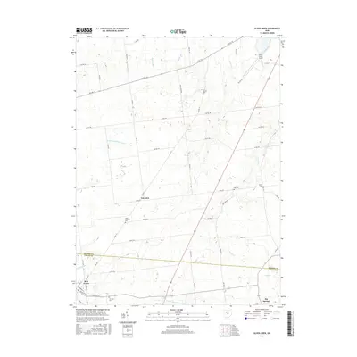
2016 Map of Silver Creek
USGS Topo · Published 2016About this map
Yelverton and the northern outskirts of Belle Center anchor this agricultural landscape along the county line between Hardin Co and Logan Co. The terrain is defined by a complex network of drainage ditches and small waterways, including Liggitt Ditch and the headwaters of the N Fork Great Miami River. This 2016 survey captures the rural character of the region, where the industrial presence of the Hardin County Airport contrasts with numerous small, family-named burial grounds like Norman Cem and Sieg Cem. The transportation grid is heavily oriented toward township and county roads, reflecting the persistent sectional surveying of the Ohio countryside. In the southern reaches, Big Springs sits near the confluence of Taylor Cr and Wolf Cr, where the land begins to transition toward the S Fork Great Miami River.
Find a feature on this map
47 named features on this map. Tap any name to fly to it.
Don’t see what you’re looking for? This feature index may not catch every label — zoom into the map to look around manually.
Map Details
Editions of this 2016 Silver Creek Map
This is the sole edition of this map. No revisions or reprints were ever made.
Other maps of this area

1913 · Alger
USGS Topo · 1:48,000

1913 · Bellefontaine
USGS Topo · 1:48,000

1913 · East Liberty
USGS Topo · 1:62,500

1915 · Alger
USGS Topo · 1:62,500

1915 · Bellefontaine
USGS Topo · 1:62,500

1915 · East Liberty
USGS Topo · 1:62,500

1915 · Kenton
USGS Topo · 1:62,500

1943 · Alger
USGS Topo · 1:62,500

1944 · East Liberty
USGS Topo · 1:62,500

1944 · Kenton
USGS Topo · 1:62,500