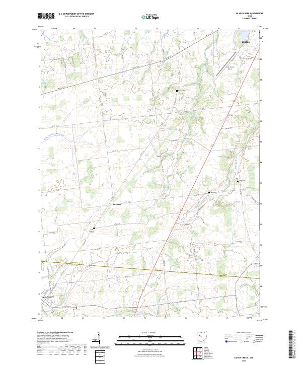
2023 Map of Silver Creek
USGS Topo · Published 2023About this map
Silver Creek flows through the center of this agricultural landscape in the headwaters of the Great Miami River system. The terrain is defined by the drainage divide between the North Fork Great Miami River and the South Fork Great Miami River, which bracket the southern half of the quadrangle. Small rural settlements like Yelverton and the edge of Belle Center serve as focal points for a dense grid of township and county roads. For genealogists, several family-named burial sites are preserved across the countryside, including the Sloan-Yelverton Cem and Norman Cem. The northern extent includes a portion of Kenton and the Hardin County Airport, while the county line between Hardin and Logan counties cuts through the southern reaches, marking the boundary of local jurisdictions in this part of western Ohio.
Find a feature on this map
56 named features on this map. Tap any name to fly to it.
Don’t see what you’re looking for? This feature index may not catch every label — zoom into the map to look around manually.
Map Details
Editions of this 2023 Silver Creek Map
This is the sole edition of this map. No revisions or reprints were ever made.
Other maps of this area

1913 · Alger
USGS Topo · 1:48,000

1913 · Bellefontaine
USGS Topo · 1:48,000

1913 · East Liberty
USGS Topo · 1:62,500

1915 · Alger
USGS Topo · 1:62,500

1915 · Bellefontaine
USGS Topo · 1:62,500

1915 · East Liberty
USGS Topo · 1:62,500

1915 · Kenton
USGS Topo · 1:62,500

1943 · Alger
USGS Topo · 1:62,500

1944 · East Liberty
USGS Topo · 1:62,500

1944 · Kenton
USGS Topo · 1:62,500