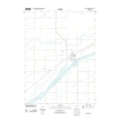
2011 Map of Silver Creek
USGS Topo · Published 2011About this map
Silver Creek serves as the central hub of this Nebraska landscape, situated near the multi-channeled waters of the Platte River. The map illustrates the town’s organization along the rail line, anchored by the Silver Creek Post Office and surrounded by a rigorous grid of agricultural roads such as Silver Creek Rd and BB Rd. This Platte Valley environment is defined by its complex hydrology, where the South Channel Platte River and smaller tributaries like Prairie Creek and Clear Creek navigate the level valley floor. Genealogists and local historians can locate the Silver Creek Cemetery north of the town center and the Saint Lawrence Cemetery to the southwest. The presence of the Fishers Cove Campground along the riverbanks highlights the area's use for local recreation amidst its primarily agrarian character.
Find a feature on this map
30 named features on this map. Tap any name to fly to it.
Don’t see what you’re looking for? This feature index may not catch every label — zoom into the map to look around manually.
Map Details
Editions of this 2011 Silver Creek Map
This is the sole edition of this map. No revisions or reprints were ever made.
Other maps of this area

1896 · Stromsburg
USGS Topo · 1:125,000

1955 · Fremont
USGS Topo · 1:250,000

1957 · Fremont
USGS Topo · 1:250,000

1958 · Fremont
USGS Topo · 1:250,000

1958 · Genoa
USGS Topo · 1:24,000

1958 · Monroe
USGS Topo · 1:24,000

1958 · Silver Creek SE
USGS Topo · 1:24,000

1958 · Fullerton NE
USGS Topo · 1:24,000

1958 · Silver Creek
USGS Topo · 1:24,000

1958 · Havens
USGS Topo · 1:24,000