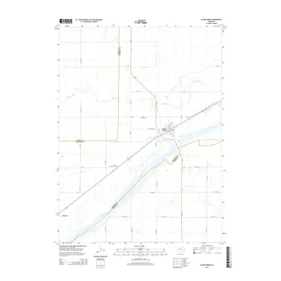
2014 Map of Silver Creek
USGS Topo · Published 2014About this map
The Platte River corridor dominates this central Nebraska landscape, defining the agricultural and transit patterns of Merrick and Polk counties. The village of Silver Creek serves as the primary hub, situated just north of the river's main flow and the S Channel Platte River. The grid of rural roads, including Silver Creek Rd and 33rd Rd, reflects a century of land division that supports the region's farming economy.
Find a feature on this map
38 named features on this map. Tap any name to fly to it.
Don’t see what you’re looking for? This feature index may not catch every label — zoom into the map to look around manually.
Map Details
Editions of this 2014 Silver Creek Map
This is the sole edition of this map. No revisions or reprints were ever made.
Other maps of this area

1896 · Stromsburg
USGS Topo · 1:125,000

1955 · Fremont
USGS Topo · 1:250,000

1957 · Fremont
USGS Topo · 1:250,000

1958 · Fremont
USGS Topo · 1:250,000

1958 · Genoa
USGS Topo · 1:24,000

1958 · Monroe
USGS Topo · 1:24,000

1958 · Silver Creek SE
USGS Topo · 1:24,000

1958 · Fullerton NE
USGS Topo · 1:24,000

1958 · Silver Creek
USGS Topo · 1:24,000

1958 · Havens
USGS Topo · 1:24,000