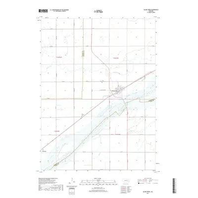
2017 Map of Silver Creek
USGS Topo · Published 2017About this map
Silver Creek sits at a strategic point north of the wide, braided Platte River valley in the eastern portion of Merrick County. This landscape is defined by its water systems, where the main river channel is joined by the South Channel Platte River, while Prairie Creek and Silver Creek meander across the agricultural flats. The settlement of Silver Creek is laid out on a grid including Vine Street and Chestnut Street, serving as a focal point for the surrounding rural sections. To the southwest, the small locality of Havens marks a distinct point along the rail and road corridor. Genealogists and local historians can find burial sites at the Silver Creek Cemetery and Saint Lawrence Cemetery, both established near the creek beds. The map shows the intricate network of county roads, such as County Road 137 and South 400th Avenue, that bind these river communities together.
Find a feature on this map
53 named features on this map. Tap any name to fly to it.
Don’t see what you’re looking for? This feature index may not catch every label — zoom into the map to look around manually.
Map Details
Editions of this 2017 Silver Creek Map
This is the sole edition of this map. No revisions or reprints were ever made.
Other maps of this area

1896 · Stromsburg
USGS Topo · 1:125,000

1955 · Fremont
USGS Topo · 1:250,000

1957 · Fremont
USGS Topo · 1:250,000

1958 · Fremont
USGS Topo · 1:250,000

1958 · Genoa
USGS Topo · 1:24,000

1958 · Monroe
USGS Topo · 1:24,000

1958 · Silver Creek SE
USGS Topo · 1:24,000

1958 · Fullerton NE
USGS Topo · 1:24,000

1958 · Silver Creek
USGS Topo · 1:24,000

1958 · Havens
USGS Topo · 1:24,000