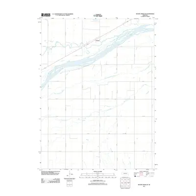
2011 Map of Silver Creek SE
USGS Topo · Published 2011About this map
Gardiner sits at the northern edge of this Platte County landscape, positioned where the regional road network meets the braided waters of the Platte River. The geography is defined by a series of parallel waterways that dictate the layout of the agricultural grid, including the Prairie Creek to the north and the South Channel Platte River further south. This 2011 survey illustrates the intricate drainage patterns of the region, where Clear Creek winds through the southern plains, crossing numerous county roads like Co RD-39 and Co RD-37. The strict section-line road system, featuring named routes such as Monroe Rd and 37th Rd, reflects a deeply organized agrarian territory where the natural hydrology of the Platte valley continues to shape the placement of infrastructure and small settlements like Gardiner.
Find a feature on this map
24 named features on this map. Tap any name to fly to it.
Don’t see what you’re looking for? This feature index may not catch every label — zoom into the map to look around manually.
Map Details
Editions of this 2011 Silver Creek SE Map
This is the sole edition of this map. No revisions or reprints were ever made.
Other maps of this area

1896 · Stromsburg
USGS Topo · 1:125,000

1899 · David City
USGS Topo · 1:125,000

1955 · Fremont
USGS Topo · 1:250,000

1957 · Fremont
USGS Topo · 1:250,000

1958 · Fremont
USGS Topo · 1:250,000

1958 · Genoa
USGS Topo · 1:24,000

1958 · Monroe
USGS Topo · 1:24,000

1958 · Duncan
USGS Topo · 1:24,000

1958 · Columbus SW
USGS Topo · 1:24,000

1958 · Silver Creek SE
USGS Topo · 1:24,000