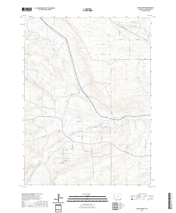
2021 Map of Silver Crown
USGS Topo · Published 2021About this map
Silver Crown is situated amidst a high-plains landscape defined by a complex network of water management and drainage systems. The terrain is crisscrossed by several branches of Crow Creek, including N Fork Crow Cr, Middle Crow Cr, and S Fork Crow Cr. These natural waterways are augmented by human engineering, most notably the Gilchrist Ditch Number 9 and Gilchrist Ditch Number 4, which likely serve local agricultural or ranching needs by diverting water through the arid Laramie County landscape. The Gilchrist Reservoir stands as a central feature in this water system.
Find a feature on this map
52 named features on this map. Tap any name to fly to it.
Don’t see what you’re looking for? This feature index may not catch every label — zoom into the map to look around manually.
Map Details
Editions of this 2021 Silver Crown Map
This is the sole edition of this map. No revisions or reprints were ever made.
Other maps of this area

1905 · Sherman
USGS Topo · 1:125,000

1911 · Cheyenne
USGS Topo · 1:125,000

1914 · Cheyenne
USGS Topo · 1:125,000

1950 · Cheyenne
USGS Topo · 1:62,500

1954 · Cheyenne
USGS Topo · 1:250,000

1958 · Cheyenne
USGS Topo · 1:250,000

1961 · Round Top Lake
USGS Topo · 1:24,000
1961 · Borie
USGS Topo · 1:24,000

1961 · Cheyenne
USGS Topo · 1:62,500

1962 · Federal
USGS Topo · 1:24,000