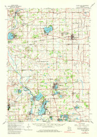
1960 Map of Silver Lake
USGS Topo · Published 1980About this map
The Fox River and Des Plaines River define this southeastern Wisconsin landscape, which was undergoing a significant transition in the early 1960s. The map clearly delineates the extensive footprint of the Richard Bong Air Force Base (Abandoned), a site that was famously halted mid-construction. This massive federal interruption sits between agricultural townships like Brighton and Paris, contrasting with the established character of villages like Union Grove and Kansasville.
Find a feature on this map
99 named features on this map. Tap any name to fly to it.
Don’t see what you’re looking for? This feature index may not catch every label — zoom into the map to look around manually.
Map Details
Editions of this 1960 Silver Lake Map
3 editions found
Other maps of this area

1891 · Bayview
USGS Topo · 1:62,500

1891 · Muskego
USGS Topo · 1:62,500

1892 · Racine
USGS Topo · 1:62,500

1892 · Eagle
USGS Topo · 1:62,500

1893 · Silver Lake
USGS Topo · 1:62,500

1893 · Geneva
USGS Topo · 1:62,500

1894 · Eagle
USGS Topo · 1:62,500

1897 · Eagle
USGS Topo · 1:62,500

1901 · Bayview
USGS Topo · 1:62,500

1901 · Muskego
USGS Topo · 1:62,500