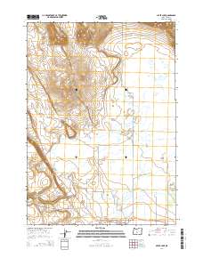
2014 Map of Silver Lake
USGS Topo · Published 2014About this map
Silver Lake serves as the central hub of this Lake County landscape, situated where the Fremont Hwy meets local routes like Center St and S St. The settlement is anchored by essential community features including the Po and the nearby Silver Lake Cem, providing a clear view of the town's footprint in the early 21st century. The surrounding terrain is defined by a complex drainage system where Silver Creek is joined by tributaries such as Buck Creek, Conley Creek, and Bridge Creek. To the north, the topographic relief rises toward the Connley Hills and Community Hills, with notable passages like Horning Gap. Water management is evident through several named catchments, most notably Grested Reservoir and Lonely Reservoir, which sit amidst the Black Hills west of the main highway corridor.
Find a feature on this map
28 named features on this map. Tap any name to fly to it.
Don’t see what you’re looking for? This feature index may not catch every label — zoom into the map to look around manually.
Map Details
Editions of this 2014 Silver Lake Map
This is the sole edition of this map. No revisions or reprints were ever made.
Other maps of this area

1955 · Crescent
USGS Topo · 1:250,000

1957 · Crescent
USGS Topo · 1:250,000

1958 · Crescent
USGS Topo · 1:250,000

1968 · Silver Lake
USGS Topo · 1:24,000

1968 · Oatman Flat
USGS Topo · 1:24,000
1968 · Hager Mtn
USGS Topo · 1:24,000
1968 · Bridge Creek Draw
USGS Topo · 1:24,000

1970 · Crescent
USGS Topo · 1:250,000

1979 · Crescent
USGS Topo · 1:100,000
1981 · Tuff Butte
USGS Topo · 1:24,000