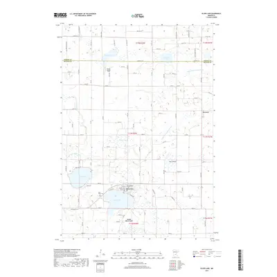
2019 Map of Silver Lake
USGS Topo · Published 2019About this map
Silver Lake serves as the central hub of this northern McLeod County landscape, surrounded by a complex system of agricultural drainage and natural water bodies. To the south, South Silver Lake and the smaller settlement of Sherman to the east anchor the local road network. The map reveals a high concentration of sites important for genealogical research, including Saint Adalbert's Catholic Cem, Saint Joseph Cem, and the Bohemian Cem tucked near Bear Cr.
Find a feature on this map
58 named features on this map. Tap any name to fly to it.
Don’t see what you’re looking for? This feature index may not catch every label — zoom into the map to look around manually.
Map Details
Editions of this 2019 Silver Lake Map
This is the sole edition of this map. No revisions or reprints were ever made.
Other maps of this area

1953 · New Ulm
USGS Topo · 1:250,000

1953 · Saint Cloud
USGS Topo · 1:250,000

1957 · Saint Cloud
USGS Topo · 1:250,000

1957 · New Ulm
USGS Topo · 1:250,000

1958 · New Ulm
USGS Topo · 1:250,000

1958 · Saint Cloud
USGS Topo · 1:250,000

1958 · Glencoe
USGS Topo · 1:62,500

1958 · Dassel
USGS Topo · 1:62,500

1958 · Cokato
USGS Topo · 1:62,500

1958 · Hutchinson
USGS Topo · 1:62,500