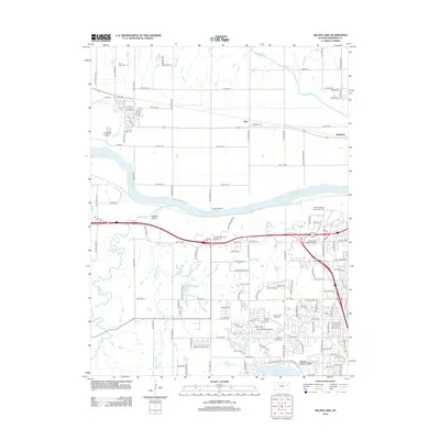
2012 Map of Silver Lake
USGS Topo · Published 2012About this map
The Kansas River flows through this Shawnee County landscape, separating the rural north from the suburban expansion of western Topeka. In the early 21st century, the northern half of the map retains its agricultural character around the small settlements of Silver Lake, Kiro, and Menoken. These communities are linked by the Union Pacific railroad corridor, which parallels the river valley. Notable local landmarks include Silver Lake Cem and the riverfront Camp Mattingly.
Find a feature on this map
124 named features on this map. Tap any name to fly to it.
Don’t see what you’re looking for? This feature index may not catch every label — zoom into the map to look around manually.
Map Details
Editions of this 2012 Silver Lake Map
This is the sole edition of this map. No revisions or reprints were ever made.
Other maps of this area

1889 · Burlingame
USGS Topo · 1:125,000

1889 · Topeka
USGS Topo · 1:125,000

1894 · Burlingame
USGS Topo · 1:125,000

1894 · Topeka
USGS Topo · 1:125,000

1947 · Lawrence
USGS Topo · 1:250,000

1950 · Kansas City
USGS Topo · 1:250,000

1950 · Lawrence
USGS Topo · 1:250,000

1950 · Topeka
USGS Topo · 1:24,000

1951 · Topeka
USGS Topo · 1:24,000

1952 · Auburn
USGS Topo · 1:24,000