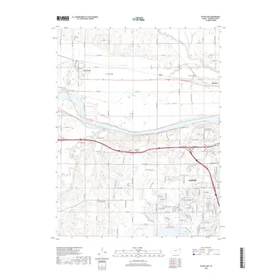
2018 Map of Silver Lake
USGS Topo · Published 2018About this map
The Kansas River carves a wide valley across this landscape west of Topeka, defining the corridor for both the Union Pacific railroad and major highway transit. Settlement patterns follow this natural thoroughfare, with the community of Silver Lake established north of the river near Ensign Creek. The map documents a blend of suburban expansion and agricultural persistence, where the grid of county roads like NW Valencia Rd meets the growing residential fringes of the capital city. Significant local history is preserved in sites such as the Silver Lake Cemetery and the Mission Center Cemetery. Further south, the terrain rises toward Hickory Knob, marking the transition away from the river flats toward the drainage of Blacksmith Creek and Shunganunga Creek.
Find a feature on this map
123 named features on this map. Tap any name to fly to it.
Don’t see what you’re looking for? This feature index may not catch every label — zoom into the map to look around manually.
Map Details
Editions of this 2018 Silver Lake Map
This is the sole edition of this map. No revisions or reprints were ever made.
Other maps of this area

1889 · Burlingame
USGS Topo · 1:125,000

1889 · Topeka
USGS Topo · 1:125,000

1894 · Burlingame
USGS Topo · 1:125,000

1894 · Topeka
USGS Topo · 1:125,000

1947 · Lawrence
USGS Topo · 1:250,000

1950 · Kansas City
USGS Topo · 1:250,000

1950 · Lawrence
USGS Topo · 1:250,000

1950 · Topeka
USGS Topo · 1:24,000

1951 · Topeka
USGS Topo · 1:24,000

1952 · Auburn
USGS Topo · 1:24,000