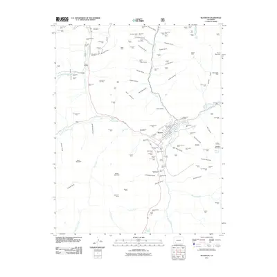
2011 Map of Silverton
USGS Topo · Published 2011About this map
Silverton serves as the focal point of this high-elevation survey, where the confluence of Mineral Creek and Cement Creek meets the Animas River. The landscape is defined by an extraordinary concentration of mining claims and deep gulches, reflecting the intense industrial heritage of the San Juan Mountains. From the Chattanooga Mine in the north to the Anglo-Saxon Mine near Minnesota Gulch, the map identifies dozens of specific prospects and shafts such as the Hidden Treasure Mine and the Gold Finch Group Mine. Access to these remote sites is documented via high-country routes like County Rd 1 and County Rd 20. South of the township, the terrain ascends toward Sultan Mountain and Grand Turk, eventually reaching the alpine waters of Molas Lake. This modern record preserves the nomenclature of a storied mining district, from the Hillside Cemetery overlooking the town to the scattered ruins of Howardsville.
Find a feature on this map
136 named features on this map. Tap any name to fly to it.
Don’t see what you’re looking for? This feature index may not catch every label — zoom into the map to look around manually.
Map Details
Editions of this 2011 Silverton Map
This is the sole edition of this map. No revisions or reprints were ever made.
Other maps of this area

1897 · Telluride
USGS Topo · 1:62,500

1897 · Silverton
USGS Topo · 1:62,500

1898 · Engineer Mountain
USGS Topo · 1:62,500

1900 · Engineer Mountain
USGS Topo · 1:62,500

1900 · Needle Mountains
USGS Topo · 1:62,500

1901 · Silverton
USGS Topo · 1:62,500

1902 · Needle Mountains
USGS Topo · 1:62,500

1902 · Silverton
USGS Topo · 1:62,500

1904 · Telluride
USGS Topo · 1:62,500

1908 · Engineer Mountain
USGS Topo · 1:62,500