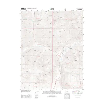
2013 Map of Silverton
USGS Topo · Published 2013About this map
Sultan Mountain and Kendall Mountain tower over the high-altitude landscape of San Juan County in this 2013 survey. The town of Silverton is situated at the confluence of the Animas River and Cement Cr, serving as a gateway to the steep, mineral-rich gulches that defined the region's mining heritage. Industrial landmarks like the Lackawanna Mill sit near the town site, while the Hillside Cem occupies a prominent position on the slopes above.
Find a feature on this map
66 named features on this map. Tap any name to fly to it.
Don’t see what you’re looking for? This feature index may not catch every label — zoom into the map to look around manually.
Map Details
Editions of this 2013 Silverton Map
This is the sole edition of this map. No revisions or reprints were ever made.
Other maps of this area

1897 · Telluride
USGS Topo · 1:62,500

1897 · Silverton
USGS Topo · 1:62,500

1898 · Engineer Mountain
USGS Topo · 1:62,500

1900 · Engineer Mountain
USGS Topo · 1:62,500

1900 · Needle Mountains
USGS Topo · 1:62,500

1901 · Silverton
USGS Topo · 1:62,500

1902 · Needle Mountains
USGS Topo · 1:62,500

1902 · Silverton
USGS Topo · 1:62,500

1904 · Telluride
USGS Topo · 1:62,500

1908 · Engineer Mountain
USGS Topo · 1:62,500