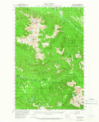
1957 Map of Silverton
USGS Topo · Published 1966About this map
Silverton and the upper reaches of the Stillaguamish River valley define this mid-century topographic survey within the Mt Baker National Forest. The landscape is characterized by its recreational and industrial footprint, featuring numerous established sites such as Camp Silverton-Waldheim and the Wiley Camp. The high-elevation terrain is dotted with mining history, notably at the St Louis Mine and Bonanza Queen Mine, while the Three Fingers Lookout stands as a prominent sentinel atop the peaks.
Find a feature on this map
112 named features on this map. Tap any name to fly to it.
Don’t see what you’re looking for? This feature index may not catch every label — zoom into the map to look around manually.
Map Details
Editions of this 1957 Silverton Map

Other maps of this area

1899 · Glacier Peak
USGS Topo · 1:125,000

1899 · Stillaguamish
USGS Topo · 1:125,000

1901 · Glacier Peak
USGS Topo · 1:125,000

1901 · Stilaguamish
USGS Topo · 1:125,000

1902 · Skykomish
USGS Topo · 1:125,000

1905 · Skykomish
USGS Topo · 1:125,000

1921 · Sultan
USGS Topo · 1:125,000

1923 · Sultan
USGS Topo · 1:125,000

1955 · Concrete
USGS Topo · 1:250,000

1956 · Oso
USGS Topo · 1:62,500