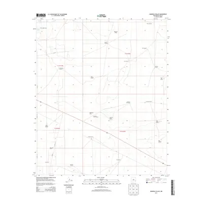
2013 Map of Simanola Valley
USGS Topo · Published 2013About this map
The Simanola Valley of Lea County defines this high plains landscape, characterized by the critical infrastructure of ranching and petroleum extraction. Windmills, the lifeblood of the arid West, are distributed across the township grids, including the Dripper Windmill, Ninemile Windmill, and Shipper Pen Windmill. The presence of the Ranger Lake Oil Field in the southwest near Jones Rd reflects the dual-use nature of the land, where traditional grazing grounds coexist with modern energy production. Natural depression features are concentrated in the Four Lakes Area to the northwest, where House Lake and Middle Lake provide intermittent water sources. The extensive network of pastoral landmarks, such as the Jones Ranch and various named pasture windmills like North Pasture Windmill and Hill Pasture Middle Windmill, illustrates the organized management of the Llano Estacado's grazing lands during the early 21st century.
Find a feature on this map
34 named features on this map. Tap any name to fly to it.
Don’t see what you’re looking for? This feature index may not catch every label — zoom into the map to look around manually.
Map Details
Editions of this 2013 Simanola Valley Map
This is the sole edition of this map. No revisions or reprints were ever made.
Other maps of this area

1954 · Brownfield
USGS Topo · 1:250,000

1958 · Brownfield
USGS Topo · 1:250,000

1961 · Johnson Ranch
USGS Topo · 1:24,000

1962 · Brownfield
USGS Topo · 1:250,000

1970 · Johnson Ranch
USGS Topo · 1:24,000

1970 · Simanola Valley
USGS Topo · 1:24,000

1970 · Tatum South
USGS Topo · 1:24,000

1970 · Alston Ranch
USGS Topo · 1:24,000

1970 · Ranger Lake
USGS Topo · 1:24,000

1970 · Tatum North
USGS Topo · 1:24,000