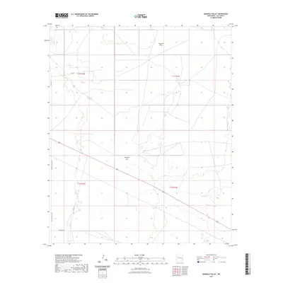
2023 Map of Simanola Valley
USGS Topo · Published 2023About this map
Simanola Valley characterizes this high plains landscape in eastern New Mexico, where the topography is defined by the subtle depression of Eightmile Draw. The survey captures a region primarily organized by the Public Land Survey System, with township boundaries like t11s r34e and t12s r35e partitioning the arid terrain. While largely open and undeveloped, the area is connected by a network of local thoroughfares including Simanola Valley Rd and the uniquely named Chameleon Rd. The map illustrates the sparse infrastructure of modern Lea County, where ranching and resource access are supported by routes such as Co Rd 161 and Farm Rd. This 2023 edition reflects the contemporary rural character of the Llano Estacado, providing a clear record of the intersection between natural drainage patterns and the human grid of section lines and county roads.
Find a feature on this map
11 named features on this map. Tap any name to fly to it.
Don’t see what you’re looking for? This feature index may not catch every label — zoom into the map to look around manually.
Map Details
Editions of this 2023 Simanola Valley Map
This is the sole edition of this map. No revisions or reprints were ever made.
Other maps of this area

1954 · Brownfield
USGS Topo · 1:250,000

1958 · Brownfield
USGS Topo · 1:250,000

1961 · Johnson Ranch
USGS Topo · 1:24,000

1962 · Brownfield
USGS Topo · 1:250,000

1970 · Johnson Ranch
USGS Topo · 1:24,000

1970 · Simanola Valley
USGS Topo · 1:24,000

1970 · Tatum South
USGS Topo · 1:24,000

1970 · Alston Ranch
USGS Topo · 1:24,000

1970 · Ranger Lake
USGS Topo · 1:24,000

1970 · Tatum North
USGS Topo · 1:24,000