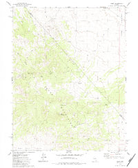
1979 Map of Simon
USGS Topo · Published 1984About this map
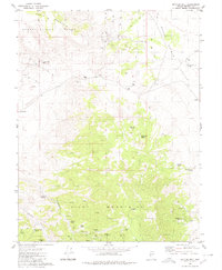
The high-desert mining settlement of Simon sits at the western base of the Cedar Mountains in this late 1970s survey of the Nevada interior. This region, straddling the border of Nye and Mineral Counties, is defined by its deep reliance on scarce water sources and mineral extraction. The landscape is punctuated by numerous mines and several prospects, including the Warrior Mine located in the northern reaches near the Ione Valley. High elevations like Simon Mtn and Little Pilot Peak overlook a network of jeep trails that connect vital watering holes such as Humdinger Spring, Lou Spring, and Simon Spring. The presence of the Douglas Spring label indicates the ephemeral nature of water in this arid environment, while the Monte Cristo Valley opens to the south below Cedar Summit.
Find a feature on this map
18 named features on this map. Tap any name to fly to it.
Don’t see what you’re looking for? This feature index may not catch every label — zoom into the map to look around manually.
Map Details
Editions of this 1979 Simon Map
2 editions found
Other maps of this area

1907 · Tonopah
USGS Topo · 1:250,000

1908 · Tonopah
USGS Topo · 1:250,000

1956 · Tonopah
USGS Topo · 1:250,000

1959 · Tonopah
USGS Topo · 1:250,000

1962 · Tonopah
USGS Topo · 1:250,000
1979 · Goldyke
USGS Topo · 1:24,000
1979 · Stewart Spring
USGS Topo · 1:24,000
1979 · Simon
USGS Topo · 1:24,000

1980 · Cole Spring
USGS Topo · 1:24,000
1980 · Bettles Well
USGS Topo · 1:24,000