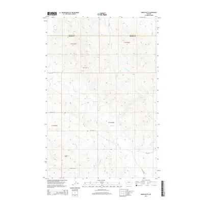
2014 Map of Simons Butte
USGS Topo · Published 2014About this map
Simons Butte rises above a highly dissected landscape on the border of Dawson and Prairie counties, where a complex network of seasonal drainages defines the local topography. This 2014 survey captures the remote rangeland of eastern Montana, showing how the terrain is etched by waterways such as Cabin Cr, Sand Butte Cr, and Ash Cr. The land is organized by an established grid of township lines including t12n r54e and t12n r55e, which are served by a sparse network of prairie roads. Significant local arteries like Cabin Creek Rd and Mildred Tower Rd provide the primary access through this territory. The drainage patterns of W Fork Hay Cr and Hog Cr suggest a landscape dominated by erosion and periodic runoff, essential for understanding the historical grazing and land-use patterns of the region.
Find a feature on this map
23 named features on this map. Tap any name to fly to it.
Don’t see what you’re looking for? This feature index may not catch every label — zoom into the map to look around manually.
Map Details
Editions of this 2014 Simons Butte Map
This is the sole edition of this map. No revisions or reprints were ever made.
Other maps of this area

1953 · Miles City
USGS Topo · 1:250,000

1957 · Miles City
USGS Topo · 1:250,000

1958 · Miles City
USGS Topo · 1:250,000

1966 · Marsh SW
USGS Topo · 1:24,000

1967 · Marsh
USGS Topo · 1:24,000

1967 · Hoyt
USGS Topo · 1:24,000
1967 · Upper Magpie Reservoir
USGS Topo · 1:24,000

1981 · Mildred NE
USGS Topo · 1:24,000

1981 · Dorothy Draw
USGS Topo · 1:24,000
1981 · Mildred
USGS Topo · 1:24,000