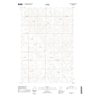
2020 Map of Simons Butte
USGS Topo · Published 2020About this map
Simons Butte rises as a prominent landmark in this eastern Montana landscape, marking the transition across the Dawson Co and Prairie Co line. The topography is defined by a dense network of coulees and gulches that channel drainage into the sprawling Cabin Cr system. Named features like Roehl Coulee, Brown Coulee, and Red Barn Coulee suggest a history of ranching and land use, with Crop Land Coulee explicitly noting the agricultural utility of these draws.
Find a feature on this map
28 named features on this map. Tap any name to fly to it.
Don’t see what you’re looking for? This feature index may not catch every label — zoom into the map to look around manually.
Map Details
Editions of this 2020 Simons Butte Map
This is the sole edition of this map. No revisions or reprints were ever made.
Other maps of this area

1953 · Miles City
USGS Topo · 1:250,000

1957 · Miles City
USGS Topo · 1:250,000

1958 · Miles City
USGS Topo · 1:250,000

1966 · Marsh SW
USGS Topo · 1:24,000

1967 · Marsh
USGS Topo · 1:24,000

1967 · Hoyt
USGS Topo · 1:24,000
1967 · Upper Magpie Reservoir
USGS Topo · 1:24,000

1981 · Mildred NE
USGS Topo · 1:24,000

1981 · Dorothy Draw
USGS Topo · 1:24,000
1981 · Mildred
USGS Topo · 1:24,000