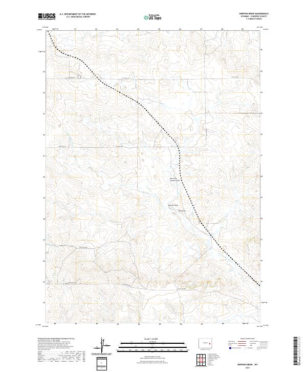
2021 Map of Simpson Draw
USGS Topo · Published 2021About this map
Simpson Draw defines this high-plains landscape in Converse County, where seasonal watercourses create a distinct drainage pattern across the township and range grid. This modern 2021 topographic survey by the U.S. Geological Survey captures the quiet infrastructure of the Wyoming rangeland, marked by a network of ranch access roads and intermittent creeks. Land use is oriented around large-scale ranching operations, as evidenced by naming conventions like York Ranch Rd and the presence of thoroughfares such as Flat Top Rd and Bill Hall Rd. The hydrology of the area is centered on the Simpson Draw and the W Fork Shawnee Cr, which gather the runoff from the surrounding basins. Along the southern boundary, E Antelope Rd provides access near Smith Cr and Sand Cr, illustrating the relationship between transport and the naturally occurring drainages that have likely dictated movement through this country for generations.
Find a feature on this map
16 named features on this map. Tap any name to fly to it.
Don’t see what you’re looking for? This feature index may not catch every label — zoom into the map to look around manually.
Map Details
Editions of this 2021 Simpson Draw Map
This is the sole edition of this map. No revisions or reprints were ever made.
Other maps of this area

1949 · Shawnee
USGS Topo · 1:24,000

1949 · Irvine
USGS Topo · 1:24,000

1949 · Clausen Ranch
USGS Topo · 1:24,000

1949 · Orin
USGS Topo · 1:24,000

1949 · Antelope Creek
USGS Topo · 1:24,000

1950 · Clausen Ranch
USGS Topo · 1:24,000

1950 · Orin
USGS Topo · 1:24,000
1950 · Irvine
USGS Topo · 1:24,000
1950 · Antelope Creek
USGS Topo · 1:24,000

1950 · Shawnee
USGS Topo · 1:24,000