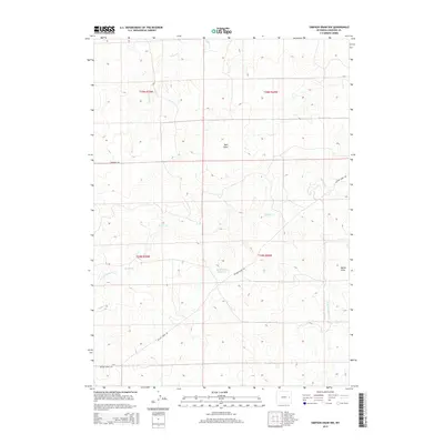
2015 Map of Simpson Draw NW
USGS Topo · Published 2015About this map
Buck Pasture Reservoir provides a central water source in this dry section of Converse County, where the landscape is defined by the complex drainage systems of Walker Cr and its tributaries. Mapping the intricate network of W Fork Walker Cr and S Fork Walker Cr, the survey illustrates how these seasonal waterways have carved significant features like Miller Draw and Well Draw into the terrain. Human presence is concentrated along long-established transport routes such as Walker Creek Rd and Robinson Rd, which cut through the public land survey townships of T34N and T35N. The pattern of development here remains closely tied to the natural hydrology of Willow Cr and the larger Walker Creek basin.
Find a feature on this map
13 named features on this map. Tap any name to fly to it.
Don’t see what you’re looking for? This feature index may not catch every label — zoom into the map to look around manually.
Map Details
Editions of this 2015 Simpson Draw NW Map
This is the sole edition of this map. No revisions or reprints were ever made.
Other maps of this area

1949 · Clausen Ranch
USGS Topo · 1:24,000

1949 · Antelope Creek
USGS Topo · 1:24,000

1950 · Clausen Ranch
USGS Topo · 1:24,000
1950 · Antelope Creek
USGS Topo · 1:24,000

1954 · Torrington
USGS Topo · 1:250,000

1955 · Newcastle
USGS Topo · 1:250,000

1958 · Torrington
USGS Topo · 1:250,000

1958 · Newcastle
USGS Topo · 1:250,000

1959 · Bill
USGS Topo · 1:62,500
1970 · The Park
USGS Topo · 1:24,000