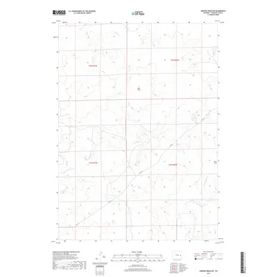
2017 Map of Simpson Draw NW
USGS Topo · Published 2017About this map
Walker Cr and its various tributaries, including the S Fork Walker Cr and W Fork Walker Cr, carve a complex drainage system through the high plains of Converse County. This landscape is defined by its deep draws and intermittent watercourses, such as Well Draw and Miller Draw, which characterize the high desert environment of eastern Wyoming. The Co Rd 43 provides the primary transit route through this open range, connecting the sparsely populated townships. To the north, Willow Cr cuts through the terrain, illustrating the natural water-driven erosion patterns of the region. The map captures a moment of modern land management, where the public land survey system remains the fundamental framework for grazing and resource rights in a territory dominated by open vistas and ephemeral streams.
Find a feature on this map
12 named features on this map. Tap any name to fly to it.
Don’t see what you’re looking for? This feature index may not catch every label — zoom into the map to look around manually.
Map Details
Editions of this 2017 Simpson Draw NW Map
This is the sole edition of this map. No revisions or reprints were ever made.
Other maps of this area

1949 · Clausen Ranch
USGS Topo · 1:24,000

1949 · Antelope Creek
USGS Topo · 1:24,000

1950 · Clausen Ranch
USGS Topo · 1:24,000
1950 · Antelope Creek
USGS Topo · 1:24,000

1954 · Torrington
USGS Topo · 1:250,000

1955 · Newcastle
USGS Topo · 1:250,000

1958 · Torrington
USGS Topo · 1:250,000

1958 · Newcastle
USGS Topo · 1:250,000

1959 · Bill
USGS Topo · 1:62,500
1970 · The Park
USGS Topo · 1:24,000