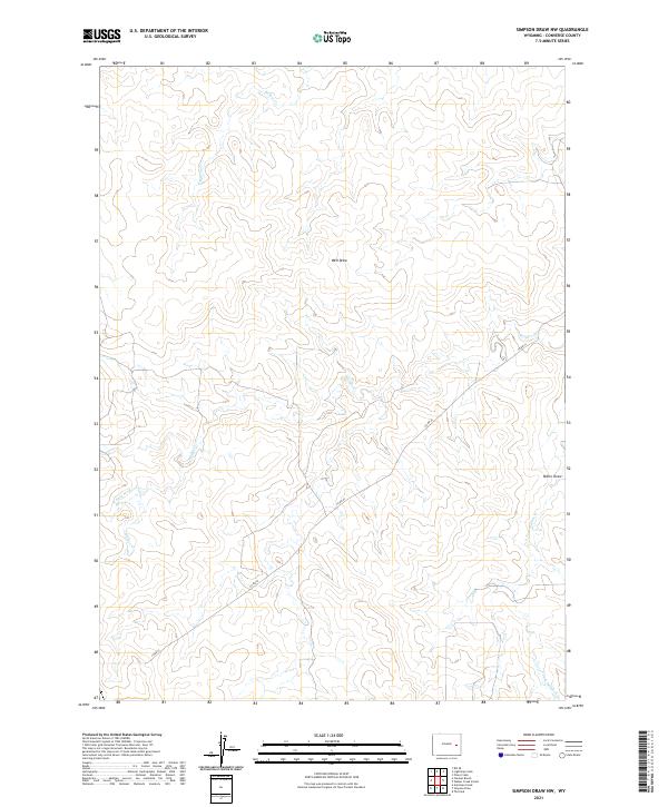
2021 Map of Simpson Draw NW
USGS Topo · Published 2021About this map
Clausen Ranch and the Walker Creek School anchor this rural landscape in Converse County, representing the persistent ranching and educational outposts in the high plains. The topography is defined by a complex network of seasonal drainages, most notably Simpson Draw, Well Draw, and Miller Draw, which carve through the terrain. These draws feed into the dendritic patterns of Walker Creek and its various branches, including the W Fork Walker Cr and S Fork Walker Cr. The mapping of these watercourses and local landmarks like Willow Cr illustrates the vital relationship between water access and land use in this part of Wyoming. Transportation is primarily facilitated by Co RD 43, which provides the main terrestrial link across the sparsely settled townships of T34N and T35N.
Find a feature on this map
15 named features on this map. Tap any name to fly to it.
Don’t see what you’re looking for? This feature index may not catch every label — zoom into the map to look around manually.
Map Details
Editions of this 2021 Simpson Draw NW Map
This is the sole edition of this map. No revisions or reprints were ever made.
Other maps of this area

1949 · Clausen Ranch
USGS Topo · 1:24,000

1949 · Antelope Creek
USGS Topo · 1:24,000

1950 · Clausen Ranch
USGS Topo · 1:24,000
1950 · Antelope Creek
USGS Topo · 1:24,000

1954 · Torrington
USGS Topo · 1:250,000

1955 · Newcastle
USGS Topo · 1:250,000

1958 · Torrington
USGS Topo · 1:250,000

1958 · Newcastle
USGS Topo · 1:250,000

1959 · Bill
USGS Topo · 1:62,500
1970 · The Park
USGS Topo · 1:24,000