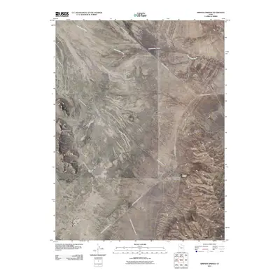
2011 Map of Simpson Springs
USGS Topo · Published 2011About this map
Simpson Springs serves as a focal point for this landscape at the edge of the Simpson Mountains. The area is defined by a sparse but essential network of desert infrastructure, including the Bureau of Land Management Campground, the Simpson Springs Campground, and the historical site of the CCC Campsite. These features suggest a region shaped by early 20th-century public works and ongoing federal land management. A series of long-distance desert routes, such as Simpson Springs-Callao Rd and Simpson Springs-Death Canyon Rd, converge here, marking the area as a critical junction for travel through the Great Basin. The terrain is characterized by the seasonal drainage of Government Creek and prominent landmarks like Simpson Buttes and Grassy Mountain.
Find a feature on this map
14 named features on this map. Tap any name to fly to it.
Don’t see what you’re looking for? This feature index may not catch every label — zoom into the map to look around manually.
Map Details
Editions of this 2011 Simpson Springs Map
This is the sole edition of this map. No revisions or reprints were ever made.
Other maps of this area

1885 · Sevier Desert
USGS Topo · 1:250,000

1885 · Tooele Valley
USGS Topo · 1:250,000

1953 · Tooele
USGS Topo · 1:250,000

1953 · Delta
USGS Topo · 1:250,000

1954 · Camels Back Ridge NW
USGS Topo · 1:24,000

1955 · Camels Back Ridge SW
USGS Topo · 1:24,000

1955 · Simpson Springs
USGS Topo · 1:24,000

1955 · Indian Peaks
USGS Topo · 1:24,000

1955 · Indian Springs
USGS Topo · 1:24,000

1955 · Camels Back Ridge NE
USGS Topo · 1:24,000