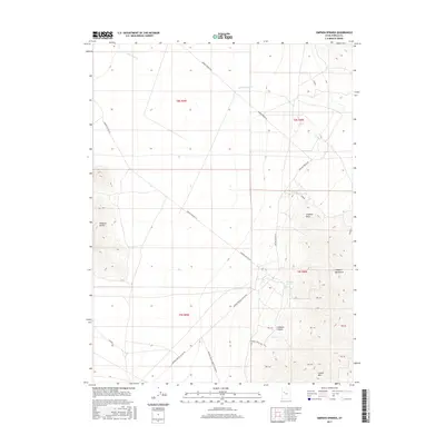
2017 Map of Simpson Springs
USGS Topo · Published 2017About this map
Simpson Springs serves as a central landmark in this arid stretch of the West Desert, where water sources dictated the path of historical travel. The landscape is defined by the elevation changes between the lower desert flats and the rising terrain of the Simpson Mountains and Simpson Buttes. A network of primitive and improved roads, including Simpson Springs Rd and Simpson Springs-Callao Rd, converges near the springs, tracing the established routes across the basin. The map details the drainage patterns of Government Cr and the topographical relief of Simpson Canyon and Grassy Mtn. This area's geography remains largely centered on the fundamental necessity of water and the rugged trails that once connected isolated outposts in Tooele County.
Find a feature on this map
23 named features on this map. Tap any name to fly to it.
Don’t see what you’re looking for? This feature index may not catch every label — zoom into the map to look around manually.
Map Details
Editions of this 2017 Simpson Springs Map
This is the sole edition of this map. No revisions or reprints were ever made.
Other maps of this area

1885 · Sevier Desert
USGS Topo · 1:250,000

1885 · Tooele Valley
USGS Topo · 1:250,000

1953 · Tooele
USGS Topo · 1:250,000

1953 · Delta
USGS Topo · 1:250,000

1954 · Camels Back Ridge NW
USGS Topo · 1:24,000

1955 · Camels Back Ridge SW
USGS Topo · 1:24,000

1955 · Simpson Springs
USGS Topo · 1:24,000

1955 · Indian Peaks
USGS Topo · 1:24,000

1955 · Indian Springs
USGS Topo · 1:24,000

1955 · Camels Back Ridge NE
USGS Topo · 1:24,000