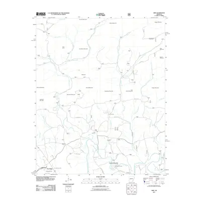
2011 Map of Sims
USGS Topo · Published 2011About this map
Sims and Pencil Bluff anchor this portion of the Ouachita Mountains, where the Ouachita River winds through a landscape of named ridges and deep creek valleys. The settlement pattern here follows the water and the roads, with the Sims Post Office and Pencil Bluff Post Office serving as central points for the surrounding rural residents. Evidence of the area's long-standing communities is found in several burial grounds, including the Barber Cemetery and Macedonia Cemetery, which are scattered among the foothills.
Find a feature on this map
57 named features on this map. Tap any name to fly to it.
Don’t see what you’re looking for? This feature index may not catch every label — zoom into the map to look around manually.
Map Details
Editions of this 2011 Sims Map
This is the sole edition of this map. No revisions or reprints were ever made.
Other maps of this area

1887 · Mount Ida #2
USGS Topo · 1:62,500

1890 · Mount Ida
USGS Topo · 1:125,000

1955 · Little Rock
USGS Topo · 1:250,000

1956 · Little Rock
USGS Topo · 1:250,000

1959 · Oden
USGS Topo · 1:62,500

1959 · Mount Ida
USGS Topo · 1:62,500

1960 · Little Rock
USGS Topo · 1:250,000

1960 · Gravelly
USGS Topo · 1:62,500
1960 · Parks
USGS Topo · 1:62,500

1964 · Little Rock
USGS Topo · 1:250,000