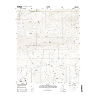
2014 Map of Sims
USGS Topo · Published 2014About this map
Sims sits at the heart of this Montgomery County landscape, positioned north of the winding Ouachita River. This 2014 survey documents the small settlements and family-named landforms that define the area, including Whitetown, Pencil Bluff, and the riverside community at Chasewood Landing. The terrain is characterized by numerous prominent peaks such as Stovall Mtn, Chalybeate Mtn, and Pilot Knob, which rise above the dense forests of the Ouachita National Forest.
Find a feature on this map
68 named features on this map. Tap any name to fly to it.
Don’t see what you’re looking for? This feature index may not catch every label — zoom into the map to look around manually.
Map Details
Editions of this 2014 Sims Map
This is the sole edition of this map. No revisions or reprints were ever made.
Other maps of this area

1887 · Mount Ida #2
USGS Topo · 1:62,500

1890 · Mount Ida
USGS Topo · 1:125,000

1955 · Little Rock
USGS Topo · 1:250,000

1956 · Little Rock
USGS Topo · 1:250,000

1959 · Oden
USGS Topo · 1:62,500

1959 · Mount Ida
USGS Topo · 1:62,500

1960 · Little Rock
USGS Topo · 1:250,000

1960 · Gravelly
USGS Topo · 1:62,500
1960 · Parks
USGS Topo · 1:62,500

1964 · Little Rock
USGS Topo · 1:250,000