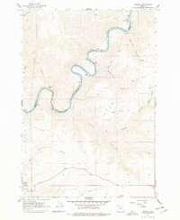
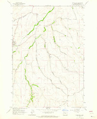
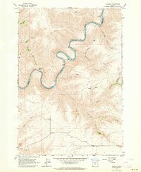
1962 Map of Sinamox
USGS Topo · Published 1978About this map
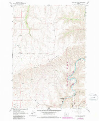
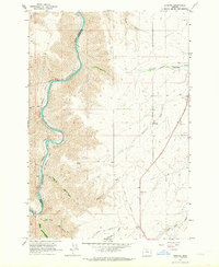
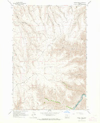
The Deschutes River carves a deep, winding path through this corner of north-central Oregon, serving as the primary boundary between Wasco and Sherman counties. The 1962 landscape is defined by the industrial presence of competing rail lines, with the Oregon Trunk and the Spokane Portland and Seattle railroads following the river's tight oxbows. These tracks pass the small railroad stops of Sinamox and Oakbrook, which provided vital transit points in this canyon-heavy terrain.
Find a feature on this map
22 named features on this map. Tap any name to fly to it.
Don’t see what you’re looking for? This feature index may not catch every label — zoom into the map to look around manually.
Map Details
Editions of this 1962 Sinamox Map
2 editions found
Other maps of this area

1930 · Dufur
USGS Topo · 1:125,000

1934 · Dufur
USGS Topo · 1:125,000

1953 · The Dalles
USGS Topo · 1:250,000

1956 · The Dalles
USGS Topo · 1:250,000

1957 · The Dalles
USGS Topo · 1:250,000
1962 · Sherars Bridge
USGS Topo · 1:24,000
1962 · Erskine
USGS Topo · 1:24,000
1962 · Summit Ridge
USGS Topo · 1:24,000
1962 · Dufur East
USGS Topo · 1:24,000
1962 · Sinamox
USGS Topo · 1:24,000