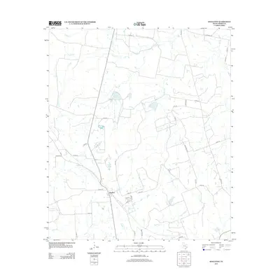
2013 Map of Singleton
USGS Topo · Published 2013About this map
Singleton serves as the central hub of this Grimes County landscape, where a network of county roads and farm-to-market routes branch out through the East Texas terrain. The area is defined by its complex drainage systems, with S Bedias Cr and Sulphur Cr carving through the countryside. Small private water bodies are a prominent feature of the local geography, including Lake Irine, Wilson Lake, and Eichenour Lake. These lakes, often situated near creek beds like Turkey Cr and Mooring Cr, suggest a land use pattern focused on ranching and rural residential development. The road network, including named paths like Hopewell Rd and Deer Fence Line, provides a clear view of how local property access and rural communities were organized in the early 21st century.
Find a feature on this map
41 named features on this map. Tap any name to fly to it.
Don’t see what you’re looking for? This feature index may not catch every label — zoom into the map to look around manually.
Map Details
Editions of this 2013 Singleton Map
This is the sole edition of this map. No revisions or reprints were ever made.
Other maps of this area

1931 · Iola
USGS Topo · 1:62,500

1954 · Beaumont
USGS Topo · 1:250,000

1954 · Austin
USGS Topo · 1:250,000

1956 · Carlos
USGS Topo · 1:62,500

1957 · Beaumont
USGS Topo · 1:250,000

1960 · Carlos
USGS Topo · 1:24,000

1961 · Singleton
USGS Topo · 1:24,000

1962 · Keith
USGS Topo · 1:24,000

1962 · Richards
USGS Topo · 1:24,000
1962 · Roans Prairie
USGS Topo · 1:24,000