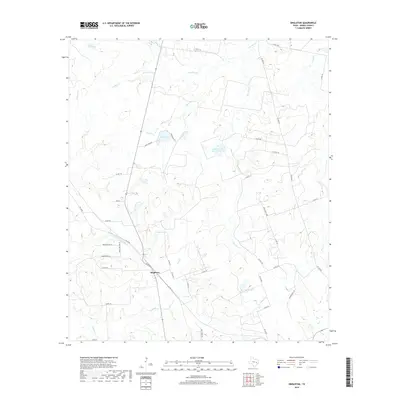
2019 Map of Singleton
USGS Topo · Published 2019About this map
Singleton serves as the central hub of this rural Grimes County landscape, situated at the intersection of several significant local arteries like FM 39 Rd and Co RD 179. The area is defined by an intricate network of waterways and small lakes that indicate a terrain shaped by drainage into the larger creek systems. Notable water features include the winding S Bedias Cr to the north and the localized Wilson Lake and Lake Irene to the west.
Find a feature on this map
46 named features on this map. Tap any name to fly to it.
Don’t see what you’re looking for? This feature index may not catch every label — zoom into the map to look around manually.
Map Details
Editions of this 2019 Singleton Map
This is the sole edition of this map. No revisions or reprints were ever made.
Other maps of this area

1931 · Iola
USGS Topo · 1:62,500

1954 · Beaumont
USGS Topo · 1:250,000

1954 · Austin
USGS Topo · 1:250,000

1956 · Carlos
USGS Topo · 1:62,500

1957 · Beaumont
USGS Topo · 1:250,000

1960 · Carlos
USGS Topo · 1:24,000

1961 · Singleton
USGS Topo · 1:24,000

1962 · Keith
USGS Topo · 1:24,000

1962 · Richards
USGS Topo · 1:24,000
1962 · Roans Prairie
USGS Topo · 1:24,000