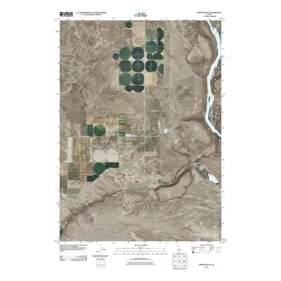
2010 Map of Sinker Butte
USGS Topo · Published 2010About this map
The Snake River carves through the eastern edge of this Ada County landscape, which is defined by high volcanic plateaus and specialized irrigation infrastructure. Settlement is sparse, represented by private holdings such as Gabica Ranch and Montini Ranch, which likely utilize the seasonal flows of Sinker Creek as it descends toward the river. The presence of the Pacific Land Company Dam indicates a history of managed water resources in this arid environment, supporting the agricultural potential of areas like Murphy Flat. Historic transportation routes are visible through the path of the Emigrant Trl, which traverses the high ground near Sinker Creek Butte. This survey provides a clear view of the relationship between local ranching operations and the prominent geological formations of Sinker Butte during the early 21st century.
Find a feature on this map
11 named features on this map. Tap any name to fly to it.
Don’t see what you’re looking for? This feature index may not catch every label — zoom into the map to look around manually.
Map Details
Editions of this 2010 Sinker Butte Map
This is the sole edition of this map. No revisions or reprints were ever made.
Other maps of this area

1892 · Bisuka
USGS Topo · 1:125,000

1892 · Silver City
USGS Topo · 1:125,000

1894 · Bisuka
USGS Topo · 1:125,000

1894 · Silver City
USGS Topo · 1:125,000

1898 · Silver City
USGS Topo · 1:125,000

1947 · Wild Horse Butte
USGS Topo · 1:24,000

1948 · Castle Butte
USGS Topo · 1:24,000

1948 · Wild Horse Butte
USGS Topo · 1:24,000

1948 · Sinker Butte
USGS Topo · 1:24,000

1949 · Sinker Butte
USGS Topo · 1:24,000