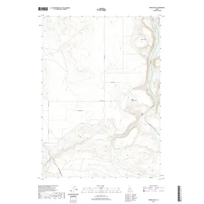
2020 Map of Sinker Butte
USGS Topo · Published 2020About this map
The Snake River carves a deep canyon through this high desert landscape, serving as a boundary for both geography and history. Evidence of early migration routes is preserved in the tracks of the Emigrant Trl and Oregon Trl, which navigate the plateaus around Sinker Butte and Sinker Creek Butte. These landmarks provide orientation in an arid environment defined by broad expanses like Murphy Flat. A poignant human touch is found at the burial site of Jacob Reuben Graves, situated near the bluffs overlooking the river. The map also delineates the transition between Ada and Owyhee counties, where modern roads like Murphy Grandview Rd follow ancient corridors. Water remains the focal point of the terrain, with Sinker Cr cutting a rugged path toward the main river channel near the Swan Falls Trail.
Find a feature on this map
22 named features on this map. Tap any name to fly to it.
Don’t see what you’re looking for? This feature index may not catch every label — zoom into the map to look around manually.
Map Details
Editions of this 2020 Sinker Butte Map
This is the sole edition of this map. No revisions or reprints were ever made.
Other maps of this area

1892 · Bisuka
USGS Topo · 1:125,000

1892 · Silver City
USGS Topo · 1:125,000

1894 · Bisuka
USGS Topo · 1:125,000

1894 · Silver City
USGS Topo · 1:125,000

1898 · Silver City
USGS Topo · 1:125,000

1947 · Wild Horse Butte
USGS Topo · 1:24,000

1948 · Castle Butte
USGS Topo · 1:24,000

1948 · Wild Horse Butte
USGS Topo · 1:24,000

1948 · Sinker Butte
USGS Topo · 1:24,000

1949 · Sinker Butte
USGS Topo · 1:24,000