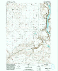
1992 Map of Sinker Butte
USGS Topo · Published 1992About this map
Snake River Birds of Prey Natural Area dominates the high canyon walls and plateaus of this Owyhee County landscape. The Snake River carves a deep path through the terrain, serving as both a county boundary and a lifeline for the desert environment. Historical transport and settlement patterns are etched into the earth here, from the pioneer tracks of the Oregon Trail (South Alternate) to the Old Ferry Site near Swan Falls. The movement of water is central to the area's development, evidenced by the Murphy Mutual Canal and an extensive aqueduct system feeding Murphy Flat. Notable family landmarks such as the Jacob Reubun Graves and the Montini Ranch offer specific points of interest for genealogists tracing the agricultural and ranching history of the region near Oreana.
Find a feature on this map
19 named features on this map. Tap any name to fly to it.
Don’t see what you’re looking for? This feature index may not catch every label — zoom into the map to look around manually.
Map Details
Editions of this 1992 Sinker Butte Map
This is the sole edition of this map. No revisions or reprints were ever made.
Other maps of this area

1892 · Bisuka
USGS Topo · 1:125,000

1892 · Silver City
USGS Topo · 1:125,000

1894 · Bisuka
USGS Topo · 1:125,000

1894 · Silver City
USGS Topo · 1:125,000

1898 · Silver City
USGS Topo · 1:125,000

1947 · Wild Horse Butte
USGS Topo · 1:24,000

1948 · Castle Butte
USGS Topo · 1:24,000

1948 · Wild Horse Butte
USGS Topo · 1:24,000

1948 · Sinker Butte
USGS Topo · 1:24,000

1949 · Sinker Butte
USGS Topo · 1:24,000