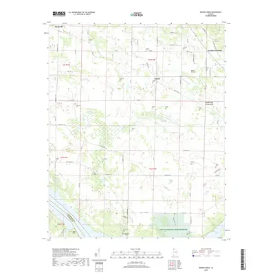
2018 Map of Sinking Creek
USGS Topo · Published 2018About this map
Key Cave National Wildlife Refuge anchors the southern portion of this Lauderdale County landscape, where the karst topography of Northwest Alabama is evident through unique hydrologic features like The Sinks, Blue Hole, and Bell Sink. The terrain is characterized by a complex network of drainage ditches such as Smith Ditch and McIntyre Ditch, reflecting the agricultural management of the fertile lands surrounding Oakland and Woodland. Local genealogy is well-preserved through numerous family-named burial grounds, including the Sherrod Cem, Pearson Cem, and Lipscomb Cem. Near the southern boundary along the Tennessee River, Roses Bluff overlooks the waters of Pickwick Lake, while the intersection of rural life is marked by historic junctions like Lovelace Crossroads and Kimbrough Crossroads.
Find a feature on this map
95 named features on this map. Tap any name to fly to it.
Don’t see what you’re looking for? This feature index may not catch every label — zoom into the map to look around manually.
Map Details
Editions of this 2018 Sinking Creek Map
This is the sole edition of this map. No revisions or reprints were ever made.
Other maps of this area

1914 · Muscle Shoals
USGS Topo · 1:48,000

1916 · Muscle Shoals
USGS Topo · 1:62,500

1924 · Tuscumbia
USGS Topo · 1:48,000

1924 · Gravelly Springs
USGS Topo · 1:48,000

1925 · Barton
USGS Topo · 1:62,500

1926 · Tuscumbia
USGS Topo · 1:62,500

1926 · Barton
USGS Topo · 1:48,000

1926 · Gravelly Springs
USGS Topo · 1:62,500

1929 · Barton
USGS Topo · 1:62,500

1935 · Cherokee
USGS Topo · 1:24,000