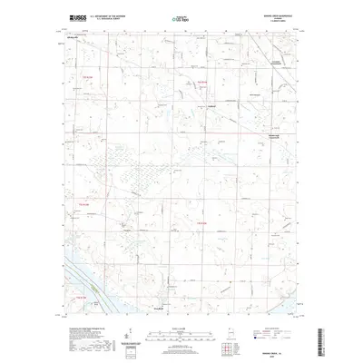
2020 Map of Sinking Creek
USGS Topo · Published 2020About this map
Woodland and Rhodesville anchor this northern Alabama landscape, which is defined by a dense concentration of family and community burial grounds reflecting generations of settlement in Lauderdale County. Numerous cemeteries such as Sherrod Cem, New Hope Cem, and Canaan Cem are scattered across the rural acreage, offering significant data points for genealogical research. The terrain is notably marked by complex karst-like hydrology, featuring several sinkhole ponds and drainage depressions like Bell Sink, Dollison Pond, and the aptly named The Sinks settlement. In the south, the land drops toward the Tennessee River valley at Roses Bluff, overlooking the expansive waters of Pickwick Lake. This 2020 map documents the modern road network, including Gunwaleford Rd and Co Rd 14, which connect small crossroads communities like Oakland and Lovelace Crossroads.
Find a feature on this map
110 named features on this map. Tap any name to fly to it.
Don’t see what you’re looking for? This feature index may not catch every label — zoom into the map to look around manually.
Map Details
Editions of this 2020 Sinking Creek Map
This is the sole edition of this map. No revisions or reprints were ever made.
Other maps of this area

1914 · Muscle Shoals
USGS Topo · 1:48,000

1916 · Muscle Shoals
USGS Topo · 1:62,500

1924 · Tuscumbia
USGS Topo · 1:48,000

1924 · Gravelly Springs
USGS Topo · 1:48,000

1925 · Barton
USGS Topo · 1:62,500

1926 · Tuscumbia
USGS Topo · 1:62,500

1926 · Barton
USGS Topo · 1:48,000

1926 · Gravelly Springs
USGS Topo · 1:62,500

1929 · Barton
USGS Topo · 1:62,500

1935 · Cherokee
USGS Topo · 1:24,000