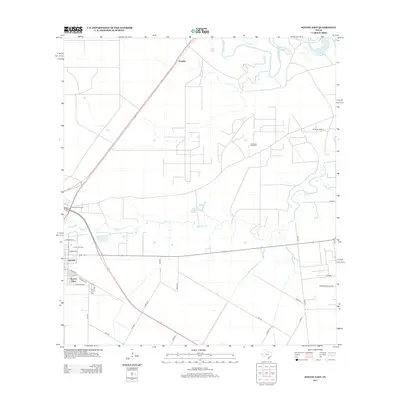
2013 Map of Sinton East
USGS Topo · Published 2013About this map
The Plymouth Oil Field and the Sinton Oil Field dominate the coastal prairie landscape east of the San Patricio county seat in this 2013 survey. The map documents a specialized industrial geography, where the Plymouth Refinery and the Plymouth Oil Camp sit amidst a network of county roads and petroleum infrastructure. To the west, the eastern edge of Sinton is visible, along with the residential area of Rancho Chico, situated near the crossing of CO Hwy-81A and Railroad Ave. Natural drainage patterns are defined by the meandering Aransas River at the northern boundary and the branching Chiltipin Cr which winds through the center of the quadrangle. The intersection of traditional ranching roots and modern extraction is evident in the presence of Ewelder north of the primary oil production zones.
Find a feature on this map
34 named features on this map. Tap any name to fly to it.
Don’t see what you’re looking for? This feature index may not catch every label — zoom into the map to look around manually.
Map Details
Editions of this 2013 Sinton East Map
This is the sole edition of this map. No revisions or reprints were ever made.
Other maps of this area

1925 · Robstown
USGS Topo · 1:62,500

1925 · Corpus Christi
USGS Topo · 1:62,500

1950 · Corpus Christi
USGS Topo · 1:250,000

1951 · Corpus Christi
USGS Topo · 1:62,500

1953 · Beeville
USGS Topo · 1:250,000

1954 · Woodsboro
USGS Topo · 1:62,500

1954 · Robstown
USGS Topo · 1:62,500

1954 · Sinton
USGS Topo · 1:62,500

1956 · Corpus Christi
USGS Topo · 1:250,000

1956 · Beeville
USGS Topo · 1:250,000
Featured Places
- Sinton, TX
- O'Farrell Acres Number 1 Colonia, TX
- Third Rancho Chico Addition Colonia, TX
- Rancho Chico Addition Colonia, TX
- Second Rancho Chico Additio Colonia, TX