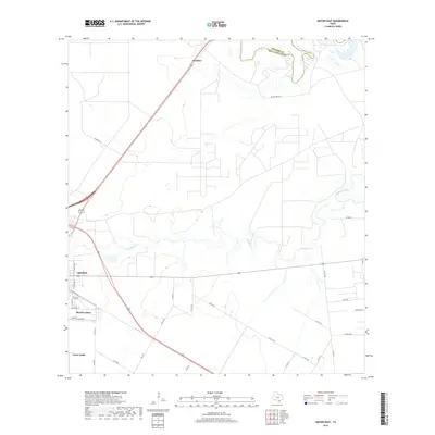
2019 Map of Sinton East
USGS Topo · Published 2019About this map
Sinton anchors the western edge of this coastal prairie landscape, where the town's residential grid meets an expansive network of rural roads and waterways. The terrain is defined by the winding course of Chiltipin Creek, which meanders eastward toward the Aransas River at the northern boundary between San Patricio and Refugio counties. Significant portions of the northeast are preserved within the Welder Wildlife area, showcasing the riparian habitats and wetlands typical of the South Texas plains.
Find a feature on this map
38 named features on this map. Tap any name to fly to it.
Don’t see what you’re looking for? This feature index may not catch every label — zoom into the map to look around manually.
Map Details
Editions of this 2019 Sinton East Map
This is the sole edition of this map. No revisions or reprints were ever made.
Other maps of this area

1925 · Robstown
USGS Topo · 1:62,500

1925 · Corpus Christi
USGS Topo · 1:62,500

1950 · Corpus Christi
USGS Topo · 1:250,000

1951 · Corpus Christi
USGS Topo · 1:62,500

1953 · Beeville
USGS Topo · 1:250,000

1954 · Woodsboro
USGS Topo · 1:62,500

1954 · Robstown
USGS Topo · 1:62,500

1954 · Sinton
USGS Topo · 1:62,500

1956 · Corpus Christi
USGS Topo · 1:250,000

1956 · Beeville
USGS Topo · 1:250,000
Featured Places
- Sinton, TX
- O'Farrell Acres Number 1 Colonia, TX
- Third Rancho Chico Addition Colonia, TX
- Rancho Chico Addition Colonia, TX
- Second Rancho Chico Additio Colonia, TX