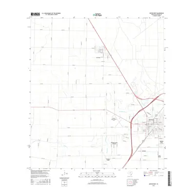
2016 Map of Sinton West
USGS Topo · Published 2016About this map
Sinton and the surrounding coastal plains of San Patricio County are defined by a grid of agricultural roads and the meandering path of Chiltipin Creek. This landscape shows a transition from the structured residential blocks of the city center to the outlying developments and farmsteads that characterize the region. The southern portion of the map is marked by distinct residential pockets such as Del Sol, Loma Linda, and Rancho Chico, which contrast with the open fields and drainage features like Peters Swale. To the north, the small settlement of St. Paul sits at a junction of county roads and the rail line, while the Alfred C 'Bubba' Thomas Airport serves as a modern transportation hub for the rural community. The map provides a clear record of land use and the scattered communities of Morgan Farm and Morgan Farm Colonia during this mid-2010s period.
Find a feature on this map
92 named features on this map. Tap any name to fly to it.
Don’t see what you’re looking for? This feature index may not catch every label — zoom into the map to look around manually.
Map Details
Editions of this 2016 Sinton West Map
This is the sole edition of this map. No revisions or reprints were ever made.
Other maps of this area

1925 · Robstown
USGS Topo · 1:62,500

1925 · Corpus Christi
USGS Topo · 1:62,500

1950 · Corpus Christi
USGS Topo · 1:250,000

1951 · Corpus Christi
USGS Topo · 1:62,500

1953 · Beeville
USGS Topo · 1:250,000

1954 · Woodsboro
USGS Topo · 1:62,500

1954 · Robstown
USGS Topo · 1:62,500

1954 · Sinton
USGS Topo · 1:62,500

1956 · Corpus Christi
USGS Topo · 1:250,000

1956 · Beeville
USGS Topo · 1:250,000
Featured Places
- Sinton, TX
- O'Farrell Acres Number 2 Colonia, TX
- Morgan Farm Area, TX
- Saint Paul, TX
- Morgan Farm Colonia, TX