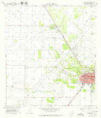
1979 Map of Sinton West
USGS Topo · Published 1979About this map
Sinton serves as the focal point of this late-1970s coastal bend survey, where the intersecting lines of the Southern Pacific and Missouri Pacific railroads define the local economy. The landscape is heavily marked by energy extraction, with a widespread Oil Field and numerous Oil Wells peppered across the flat terrain north of Chiltipin Creek. Community life is centered around Rob and Bessie Welder Park and the local Rodeo Ground, reflecting the region's ranching and agricultural roots alongside its industrial growth. Further north, the small settlement of St Paul sits along the rail line, while features like the Sinton Airport and Sinton Siding illustrate the transportation infrastructure of San Patricio County during this era.
Find a feature on this map
35 named features on this map. Tap any name to fly to it.
Don’t see what you’re looking for? This feature index may not catch every label — zoom into the map to look around manually.
Map Details
Editions of this 1979 Sinton West Map
This is the sole edition of this map. No revisions or reprints were ever made.
Other maps of this area

1925 · Robstown
USGS Topo · 1:62,500

1925 · Corpus Christi
USGS Topo · 1:62,500

1950 · Corpus Christi
USGS Topo · 1:250,000

1951 · Corpus Christi
USGS Topo · 1:62,500

1953 · Beeville
USGS Topo · 1:250,000

1954 · Woodsboro
USGS Topo · 1:62,500

1954 · Robstown
USGS Topo · 1:62,500

1954 · Sinton
USGS Topo · 1:62,500

1956 · Corpus Christi
USGS Topo · 1:250,000

1956 · Beeville
USGS Topo · 1:250,000
Featured Places
- Sinton, TX
- Loma Linda Colonia, TX
- Gonzales 12 Colonia, TX
- Sun Country Estates Colonia, TX
- Sunkist Country Estates Colonia, TX