
1962 Map of Sioux Falls West
USGS Topo · Published 1964About this map
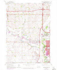
Skunk Creek winds through the western outskirts of the growing city of Sioux Falls, marking a landscape in the midst of post-war suburban and industrial expansion. The city's reach is evidenced by the concentration of public and private institutions on the eastern edge of the sheet, including the VA Hospital, Childrens Home, and Boys Ranch. Educational growth is clear with the appearance of O'Gorman High Sch and several neighborhood schools like Addams Sch.
Find a feature on this map
40 named features on this map. Tap any name to fly to it.
Don’t see what you’re looking for? This feature index may not catch every label — zoom into the map to look around manually.
Map Details
Editions of this 1962 Sioux Falls West Map
Other maps of this area

1897 · Canton
USGS Topo · 1:125,000

1900 · Canton
USGS Topo · 1:125,000

1955 · Sioux Falls
USGS Topo · 1:250,000

1958 · Sioux Falls
USGS Topo · 1:250,000

1962 · Renner
USGS Topo · 1:24,000

1962 · Harrisburg
USGS Topo · 1:24,000

1962 · Sioux Falls East
USGS Topo · 1:24,000

1962 · Tea
USGS Topo · 1:24,000

1962 · Hartford South
USGS Topo · 1:24,000

1962 · Lennox NW
USGS Topo · 1:24,000
Featured Places
- Sioux Falls, SD
- Wayne Township, SD
- Delapre Township, SD
- Sioux Falls Township, Sioux Falls
- Reppert Addition, Wayne Township