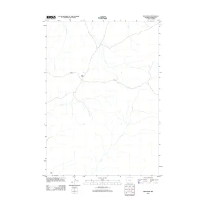
2012 Map of Sioux Pass
USGS Topo · Published 2012About this map
Sioux Pass and the nearby Devils Slide anchor this 2012 survey of Natrona County, depicting a landscape defined by its network of high-country drainage systems. The map traces the paths of Sioux Cr, Clear Cr, and Trout Cr as they cut through the terrain, illustrating the hydrologic character of this part of Wyoming. Human presence is sparse, concentrated at the Welby Ranch in the southwest corner and along the Oakie Trl, which traverses the central portion of the quadrangle. This layout reflects the area's continued reliance on ranching and traditional trails into the 21st century. The map also records several other minor waterways including Lone Tree Cr and Bear Cr, providing a clear view of the local topography and water resources in the era just after the turn of the millennium.
Find a feature on this map
9 named features on this map. Tap any name to fly to it.
Don’t see what you’re looking for? This feature index may not catch every label — zoom into the map to look around manually.
Map Details
Editions of this 2012 Sioux Pass Map
This is the sole edition of this map. No revisions or reprints were ever made.
Other maps of this area

1952 · Cottonwood Pass
USGS Topo · 1:24,000

1952 · Badwater
USGS Topo · 1:24,000

1952 · Lysite SE
USGS Topo · 1:24,000

1952 · Sioux Pass
USGS Topo · 1:24,000

1952 · Badwater NE
USGS Topo · 1:24,000

1952 · Battle Mountain
USGS Topo · 1:24,000

1952 · Badwater SE
USGS Topo · 1:24,000

1955 · Arminto
USGS Topo · 1:250,000

1958 · Arminto
USGS Topo · 1:250,000

1962 · Arminto
USGS Topo · 1:250,000