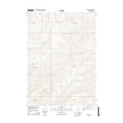
2015 Map of Sioux Pass
USGS Topo · Published 2015About this map
Sioux Pass and the notable geological formation known as Devils Slide anchor this 2015 topographic study of Natrona County, Wyoming. The landscape is defined by a dense network of high-altitude drainages, including Sioux Cr, Trout Cr, and Clear Cr, which carve through the terrain. Evidence of rural access is minimal, primarily centered on Cr-101, which provides a corridor through the complex topography of the southern Bighorn Mountains region. The map meticulously documents the intersection of several townships, including t40n r89w and t40n r88w, illustrating how modern land management and public land survey systems overlay this sparsely populated ranching and wilderness area. Local water sources like Lone Tree Cr and Bear Cr further emphasize the hydrological patterns that have historically influenced movement and land use in this part of Wyoming.
Find a feature on this map
14 named features on this map. Tap any name to fly to it.
Don’t see what you’re looking for? This feature index may not catch every label — zoom into the map to look around manually.
Map Details
Editions of this 2015 Sioux Pass Map
This is the sole edition of this map. No revisions or reprints were ever made.
Other maps of this area

1952 · Cottonwood Pass
USGS Topo · 1:24,000

1952 · Badwater
USGS Topo · 1:24,000

1952 · Lysite SE
USGS Topo · 1:24,000

1952 · Sioux Pass
USGS Topo · 1:24,000

1952 · Badwater NE
USGS Topo · 1:24,000

1952 · Battle Mountain
USGS Topo · 1:24,000

1952 · Badwater SE
USGS Topo · 1:24,000

1955 · Arminto
USGS Topo · 1:250,000

1958 · Arminto
USGS Topo · 1:250,000

1962 · Arminto
USGS Topo · 1:250,000