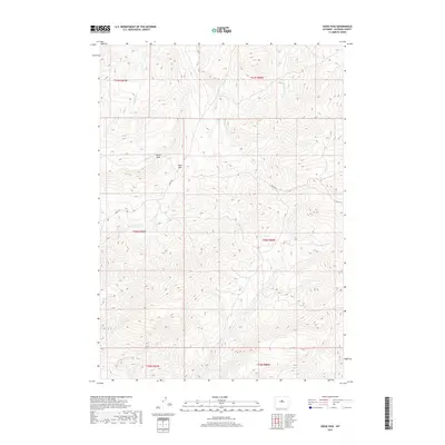
2017 Map of Sioux Pass
USGS Topo · Published 2017About this map
Sioux Pass serves as a central landmark in this high-elevation corner of Natrona County, where the terrain is defined by a dense network of seasonal drainages and steep ridges. The northern reaches of the quadrangle are marked by the Devils Slide, a distinctive topographical formation situated near the headwaters of Lone Tree Creek. This landscape remains largely undeveloped, with movement through the area dictated by the path of the Oakie Trail, which winds through the central and eastern sections. Numerous creeks, including Bear Creek, Trout Creek, Sioux Creek, and Clear Creek, flow through the deep draws of the Big Horn Mountains' southern foothills. The map provides a detailed view of the Public Land Survey System (PLSS) townships, illustrating the intricate township and range divisions that govern this section of Wyoming.
Find a feature on this map
14 named features on this map. Tap any name to fly to it.
Don’t see what you’re looking for? This feature index may not catch every label — zoom into the map to look around manually.
Map Details
Editions of this 2017 Sioux Pass Map
This is the sole edition of this map. No revisions or reprints were ever made.
Other maps of this area

1952 · Cottonwood Pass
USGS Topo · 1:24,000

1952 · Badwater
USGS Topo · 1:24,000

1952 · Lysite SE
USGS Topo · 1:24,000

1952 · Sioux Pass
USGS Topo · 1:24,000

1952 · Badwater NE
USGS Topo · 1:24,000

1952 · Battle Mountain
USGS Topo · 1:24,000

1952 · Badwater SE
USGS Topo · 1:24,000

1955 · Arminto
USGS Topo · 1:250,000

1958 · Arminto
USGS Topo · 1:250,000

1962 · Arminto
USGS Topo · 1:250,000